
SkyeBrowse has released a Roof Damage Analysis tool that turns footage from one drone flight into roof measurements and a damage screening report. The update also expands GIS and CAD exports and adds new ground control point correction options.
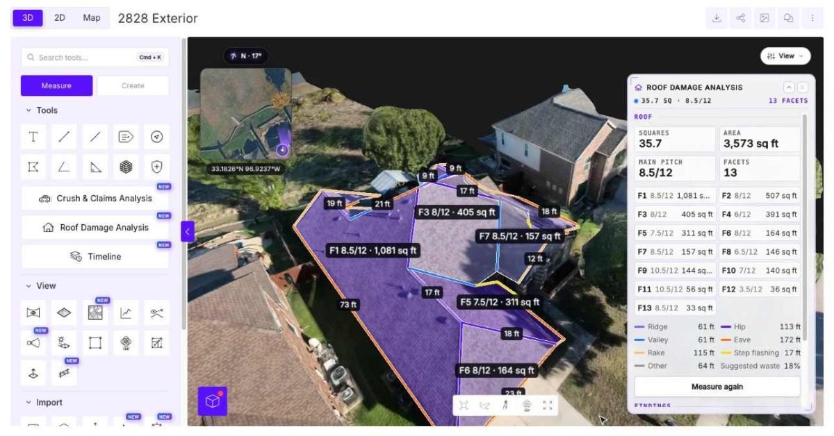
The new Roof Damage Analysis tool is aimed at roofing contractors, insurance adjusters, surveyors and public safety teams. After a pilot uploads footage of a property, the platform builds a 3D model, identifies the roof and outlines its facets. The software reports total area in roofing squares, main pitch, facet count, and pitch and area for each facet, along with lengths of ridges, hips, valleys, eaves, rakes and step flashing. Users can adjust the outlines by hand if the automatic results need changes.
An AI scanning feature reviews up to 16 frames from the flight and eight gallery photos, looking for signs such as hail impacts, missing shingles, and rust. Findings are marked as either “Likely” or “Possible” on the 3D model. An inspector must approve or reject each one before it reaches the report, and SkyeBrowse presents the tool as a screening aid rather than a replacement for professional inspection. A Weather tab also pulls NOAA storm reports from the past year within 40 kilometers of the property.
The release also adds a 2D Map export with formats for software such as ArcGIS Pro, AutoCAD and Google Earth, plus a Contours DXF export. Surveyors can now mark ground control points as Control or Check points and apply vertical offset, 3D shift or seven-parameter corrections to the model.
The new features are available on Pro models at $49.99 each, or $39.99 with annual billing, and on Public Safety and Enterprise plans.
Source: DroneDJ